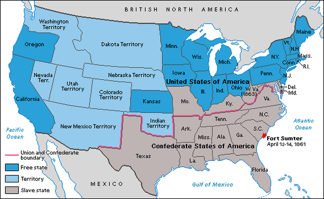
The map above shows who were the free states and the slave states, then it shows a different type like territory. Fort Sumter is also located on the map to show exactly where it is. If you look closely at Fort Sumter you can see the month, days, and year of when it was captured by the confederate army. The borderline is there so you can view the map a little easier.
Overland Campaign
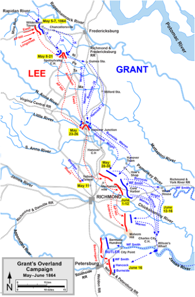
This map on the left side of this page, shows what both generals were aiming to take over during the Civil War. The blue lines are the Union's campaign which are commanded by Union General Ulysses S. Grant and the red lines are the Confederates campaign which are led by Confederate General Robert E. Lee. This Campaign map also shows all the battles that took place during the Civil War with their locations. On the bottom left of this map it shows when Grants Overland Campaign took place.
